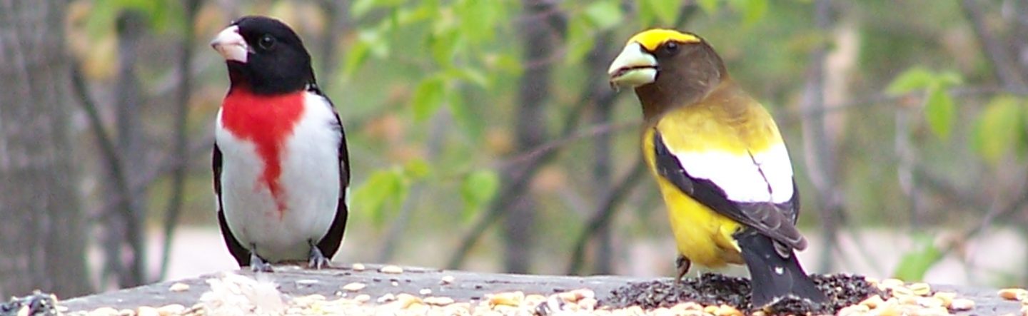
The map represents
our 50 km. radius birding area. Situated in the upper Ottawa valley
in eastern Ontario, Canada, 292 species of birds have been recorded.
The Ottawa River ( the only river on the map) is used as a flyway by
many waterfowl, shorebirds, gulls and terns in spring and fall
migration. Specific dates can be viewed by taking a look at our bird dates (103Kb pdf)
charts. Our birding area is about 1/3 farmland and 2/3 forest.
Birding can be good in the many nooks and crannies, but some areas
have been exceptional.
Lake Dore is the
largest lake in North America with no islands, and is about 8 km. in
length and 5 km. in width. The lake is located about 8 km. north of
Eganville on Hwy. 41.
You will find a cottage road, Church Point
Rd., that runs along the southeast corner of Lake Dore. Church Point
Rd. starts from Hwy 41 and curves back to Hwy. 41 and should be no
trouble to locate. Most of the road is elevated and provides good
views of the lake Spots 1-4. Hwy. 41
hugs the east side of the lake, Spot 5,
north of Church Point Rd., so that all of the east side of the lake
can be birded.
Three public boat launches exist: 10 - at the south end at Warren's Bay, on
the side road running along the south end of the lake; 6- at the northeast corner of the lake, 100
meters south of the Wilberforce Township Park, which can be found on
a short loop road off Hwy 41. The park, by the way, is a picnic park
with a shallow, sandy swimming area, ideal for young children; 7.-.see Biederman Park below.
The north and west sides of the lake are
more difficult to access because much of the shoreline consists of
private cottages, so that permission must be sought for access to
the lake. The Lake Dore Road (County Road 30) is the road that runs
along the north and west side, running between Hwy 41 at the north
end of Lake Dore and the town of Golden Lake to the southwest. There
are a few rustic cabins on the northwest corner of the lake, rented
by the Brose family (613 625-2113). Further southwest along Lake
Dore Road is a new subdivision called Dore View Estates. A left turn
into the subdivision will lead you to 7-Biederman
Park. Here there is a rough boat launch and picnic area. It is a
good scoping location. Watch for Spotted Sandpipers in Summer. Also,
a large significant wetland will be visible in the southwest corner
of the lake. A canoe is needed for the marsh. This area of the lake
is weedy, so motors will tend to get fowled up. Common Loon,
Mallard, Common Merganser, Common Tern, Marsh Wren, Common
Yellowthroat and Swamp Sparrow nest here. Watch for Eastern
Meadowlarks in the surrounding fields. 8
Lime Kiln Rd is a short rough road where you can find a wetland
and nesting habitat for Olive-sided Flycatcher. The flycatcher is at
the far bridge (600m.) in most years. Listen for its 'quick three
beers' song or its 'pip-pip-pip' call. Look for warblers in
migration.
Between mid May and early November, Common
Loon is always visible, reaching high numbers in mid July (as many
as 52 have been counted). Only 1 or 2 pairs nest on the lake,
though, while the other loons find the food search exceptional. In
fact, gulls, grebes, ducks and cormorants occur in large numbers on
Lake Dore for this reason. Red-throated Loon is rare in May and
October/November but possible. Horned Grebe and Red-necked Grebe are
uncommon in Spring and very common in Fall. Tundra Swan occurs in
November sometimes. Snow Geese are rare but flocks of Brant are
possible near mid-May and occasionally in October. Flocks of Canada
Goose are common in the Spring and Fall. Diving ducks can be seen
from ice break-up in late April to late May and again in October
till freeze-up in late November. Many unusual species for the area
have been seen on Lake Dore. Expect the unexpected!
Three tent and trailer parks are situated at
the south end of the lake. From Church Point Rd., go west on the
road that runs around the south end of the lake. Cedar Grove Park
(613-628-5265), Smith's Bay Campsite (613-628-5264), Lake Dore Tent
& Trailer Park, which has camping (613-628-2615).
9. An
interesting side trip is to the 92 acre, original mixed forest,
found by turning right (east) on County Road 9 from Hwy 41 at the
north end of Lake Dore, just south of the Snake River bridge. Little
of the original forest is left in Renfrew County, most of it being
in remote areas. Travel a couple of kilometers to two large wooden
signs on the right. This forest has been preserved by the Shaw
family and the Nature Conservancy for scientific study. It is open
to the public and free access is gained by entering the path at the
signs. Species such as Hairy, Downy and Pileated Woodpeckers,
Eastern Wood-Pewee, Great-crested Flycatcher, Least Flycatcher,
White and Red-breasted Nuthatches, Brown Creeper, thrushes, vireos,
warblers, Rose-breasted Grosbeak, Scarlet Tanager and White-throated
Sparrow, can be found from May through August.
The
Ottawa River
The Ottawa River
- From Lake Timiskaming to the St. Lawrence River, there are a
number of hydro-electric dams on the Ottawa River. The river water
levels can vary, being usually lower in August, just in time for the
southward passage of shorebirds and higher in the Spring and Fall,
good for finding grebes, cormorants, ducks, gulls and terns.
Bald Eagles are found every winter at
Rapides-des-Joachims, about 12 km. west of Deep River. This is just
east of Rolphton, turn north on Hwy. 635. Follow the road a few km.
to the river, which stays open in winter at this point. With
patience, you will see eagles, Common Raven, Common Merganser,
Common Goldeneye and a gull or two.
The Deep River, Petawawa and Pembroke
waterfronts have good birding. Check out the beaches and marinas.
There are parks and side roads that are worth exploring in these
towns and along old 17, which runs between Petawawa and
Pembroke.
East of Pembroke, take Pembroke St. East
(Hwy.148) out of town and take the turnoff to the Province of
Quebec. Along this road are three bridges (the first over railway
tracks). After the second bridge you are in Quebec, 'la belle
province' and on
Morrison Island. The
island is bordered by rapids and the water stays open in winter.
Common Goldeneye, Common Merganser and usually a Barrow's Goldeneye
or Harlequin Duck over winter on the east side above and below the
rapids.
Returning to Ontario, the area along the
Ottawa River west of Westmeath is good for birding. Turn south on
Pembroke St. East and go 4 km. or so to County Road 21. Turn left on
21 and travel to County Road 12 and turn left again. You can't see
the Ottawa River along this road, but turn onto Moore's Beach Rd.
and/or Sand Point Rd. for access to the river. From Sand Point Rd.,
one can walk the beach east into Westmeath Provincial Park (see next
area). Shorebirds such as yellowlegs, peeps and plovers can be found
in migration. Also, in late September and early October, walk the
beach grasses for Nelson's Sharp-tailed Sparrow, Swamp Sparrow and
Song Sparrow, American Pipit and Lapland Longspur. In May to July,
walk into Westmeath Provincial Park (so far, an undeveloped park,
thank goodness!) which is a little further east on County Road 12
from Sand Point Rd. Look for the locked iron gate, park and walk or
cycle in. Watch for accipiters, Ruffed Grouse, Yellow-bellied
Sapsucker, Northern Flicker, Blue Jay, Black-capped Chickadee,
Red-breasted Nuthatch, Winter Wren, vireos, warblers, Baltimore
Oriole and Purple Finch. Also in the park, Bellow's Bay (take the
right fork when walking in) is a protected bay of the Ottawa River
and in late April is a staging area for migrating ducks. Dabblers
such as Wood Duck, Green-winged Teal, American Black Duck, Northern
Pintail, and Northern Shoveler and diving ducks such as Ring-necked
Duck, scaup, Bufflehead, and Hooded Merganser are seen. Rusty
Blackbirds pass through in April and Eastern Phoebe and
Golden-crowned Kinglets are seen then, too. If you follow either
fork, you can get to the beautiful, unspoiled beach. Be aware of the
Poison Ivy in this Park.
If you can find the boat launch and
municipal dock in the town of Westmeath (turn left in town at the
blue, wood-sided building before the bridge), you can scan a large
expanse of the Ottawa River as well as a shoreline of reeds and grasses.
Further down river from Westmeath, between
La Passe and Forester's Falls are the famous rafting companies:
Esprit (819-683-3241), Owl (613-646-2263), River Run (613-646-2501)
and Wilderness Tours (613-646-2291). This area of the Ottawa River
is good Osprey nesting habitat.
Algonquin Provincial Park
Algonquin Provincial
Park is a world famous destination for travelers. As well as
the opportunity to view Black Bear, Moose, White-tailed Deer and
Beaver, birders seek out boreal species such as Gray Jay,
Black-backed Woodpecker, Boreal Chickadee and Spruce Grouse.
Canoeing, camping and hiking is exceptional. To reach the northeast
side of the Park, take Hwy.17 to the Achray Road South exit, then
follow the signage for Algonquin Park. It will seem like a long
drive (32 km.) to the entrance gate, but there are some wetlands and
second growth on the way you may want to check. Once in the park,
you will find continuous pine forest. Many warbler species can be
found from May to September, such as Nashville, Chestnut-sided,
Magnolia, Black-throated Blue, Yellow-rumped, Black-throated Green,
Blackburnian and Pine to name a few. Other species found in
Algonquin are Common Loon, Broad-winged Hawk, Ruffed Grouse,
Solitary Sandpiper (rare), Black-billed Cuckoo, Barred Owl, Belted
Kingfisher, Pileated Woodpecker, Yellow-bellied Sapsucker,
Great-crested Flycatcher, Common Raven, Brown Creeper, Winter Wren,
Veery, Solitary Vireo, Scarlet Tanager, Rose-breasted Grosbeak and
Purple Finch. To find Yellow-bellied Flycatcher (late May to early
July), look for the sign for the Barron River Canyon trail at 10.5
km. from the Park's Sand Rd. east gate. Park in the lot and walk the
1.5 km.loop trail to the top of the canyon. From the top of the 100
meter high granite walls, you may hear the flycatchers (in the
riparian zone upriver towards Brigham Chute) as well as Hermit
Thrush, Northern Waterthrush, Dark-eyed Junco. Black-backed
Woodpecker (unusual), Gray Jay and Olive-sided Flycatcher are
possible along the trail. Canoeing in the canyon will ensure you
hear Yellow-bellied Flycatcher. There is a canoe outfitter (
Algonquin Portage Store) on the road into the park. Rental canoes
and Algonquin Park literature are available there.
(613-735-1795)
Quebec
Quebec -
Continuing along Hwy.148 past Morrison Island, you land on Allumette
Island. This island has good open country birding for raptors such
as Red-tailed Hawk, Rough-legged Hawk (Spring/Fall), American
Kestrel, and in winter such species as Snowy Owl, Northern Hawk-Owl,
Great Gray Owl (these northern owls appear some years), Snow Bunting
and Northern Shrike. Virginia Rail can be heard (May to July) in the
small wetlands on the eastern end of the island. By going onto the
mainland across the bridge from Chapeau and turning west, there is
an interesting area of forest and farmland around Sheenboro, Fort
William and Nicabong. The road from Fort William along the Ottawa
river running north is a beautiful drive and glimpses of the rugged
hills (the Laurentians) to the north conjure up a rugged wilderness.
There are secondary roads into this northwestern area of Pontiac
County, but they can be rough and rocky. Topographic maps containing
these portions of the PAFN birding circle in Pontiac County are 31
F/14, 31 F/15, 31 K/2 and 31 K/3. These maps can be purchased at World of
Maps in Ottawa.
Returning east to Waltham and Fort Coulonge,
try roads going north into the hills and river valleys. This is
exploratory birding and you can expect surprises. Mourning Warblers
nest in this area. The road into Davidson is good for birding as
there is a wetland along the road and in Davidson, turn right down
to the municipal dock to view the Ottawa River. Further east, Fort
Coulonge has a sewage lagoon, which is a half km. or so east of town
on the main street. Look for a side road running south. There is a
house on the corner. The area around Otter Lake has been well
explored by birders from the Ottawa Field
Naturalists.